While aerial photography has been around since Nadar took the first photograph from a balloon in 1858, it is only in the last 50 years that the proliferation of small airplanes has allowed almost anyone to take pictures from the air. Helicopters have been another option, but the greater expense has limited their use to serious professionals. In the last decade or so small electronic drones have dramatically brought the expense down so that practically anyone can use them. Compared to airplanes, drones are obviously much cheaper to buy and use and have become ridiculously easy to operate, but they do still have some limitations.
The problem in the United States is that the FAA currently limits the maximum altitude they can be flown to 400 feet above the ground and they must remain in the line of site of the operator. Depending on the feature that you are trying to photograph this may be fine, but sometimes you are looking for a different perspective, in which case a small airplane is the better choice.
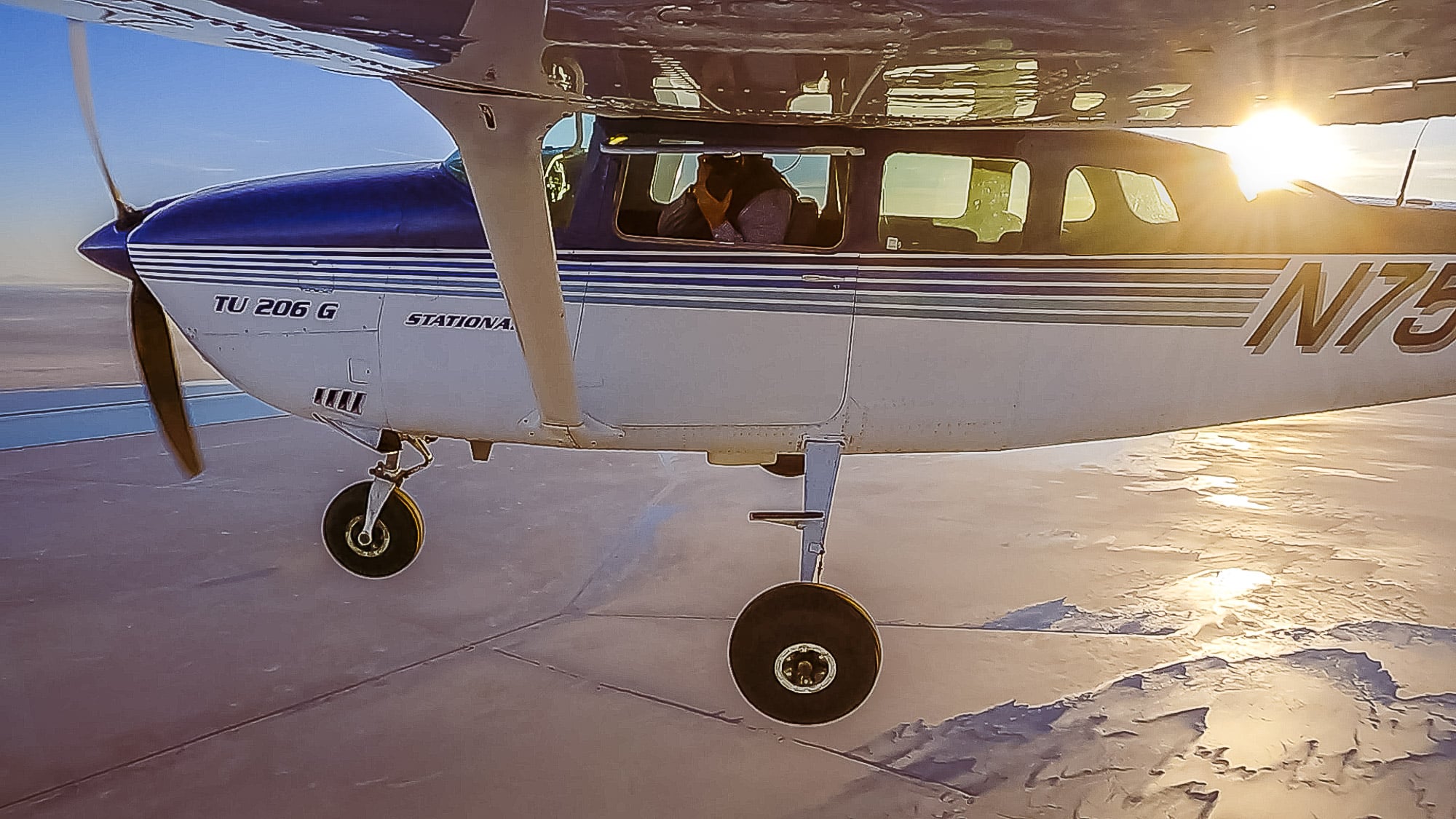
I have been extensively photographing the landscape from the window of my Cessna 206 for the better part of fifteen years and find it to be the optimal platform for me. I can use whatever camera I can hold in my hand and can quickly travel to the subject area shooting from practically any altitude over several hours. When I am shooting I use the autopilot to keep the airplane stably flying, directing it to turn over my subject area so I can see it from all sides. I open the window to my left, point the camera out and start shooting, careful to avoid including the wing, strut or landing gear in the composition.
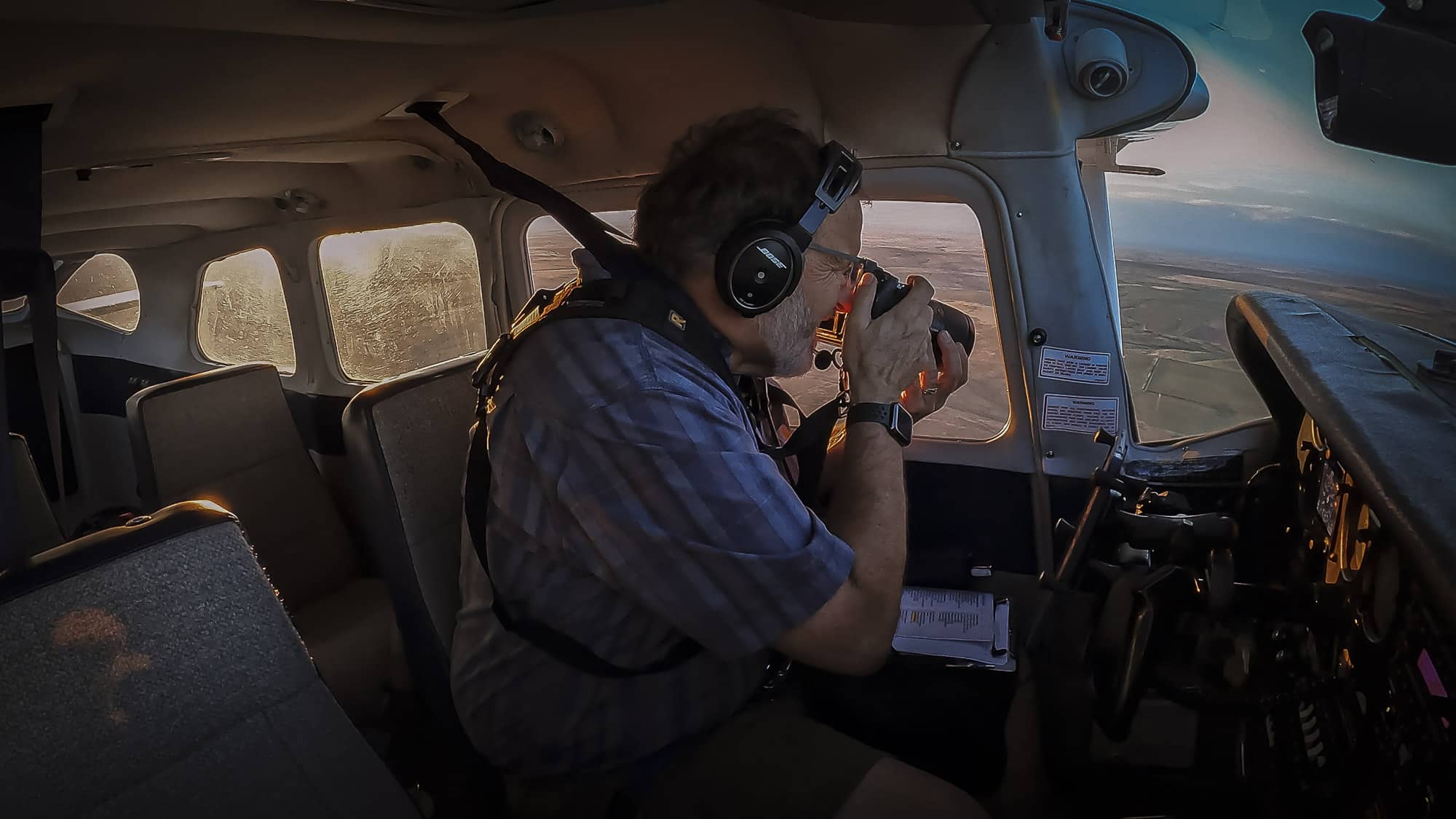
My first priority is obviously to fly the airplane, so I keep an ear out to hear any potential change that would indicate a problem. For complicated locations I will slow the airplane as much as possible to ensure I get the best photograph possible.
Should you find yourself lucky enough to be able to shoot from a small airplane, I wanted to offer these tips that might help you get the best images possible.
Plan with the pilot – It is good to talk with the pilot before the flight about particulars of their airplane, such as where you will be sitting and what direction you will be shooting. If there is a window you are allowed to open, have the pilot demonstrate how to do that safely. If there is a strut that prevents the window from opening all the way, ask if there is a way to remove it (I do that on my airplane). Try to get a sense of how high above the ground you will be flying and how low the pilot is willing to go. Determine if the pilot is willing to circle around anything that interests you. Use GoogleMaps or GoogleEarth to help previsualize what you might be seeing and plan some shots that you want to acquire.
Beverages – Everyone likes to stay hydrated, but remember that small airplanes generally don’t have bathrooms and plan accordingly.
Clothing – It is important to have the right clothing for the season, keep in mind about the possibility of wind chill if the window is open, bring a hat and gloves for temperatures below 40° F.
Camera equipment – Most SLR/mirrorless cameras are suitable for shooting from an airplane and a zoom lens is preferred so you can get a range of angles from wide to slightly telephoto. Since the airplane is moving it is unlikely you will get a sharp photograph using a long telephoto. If you are able to open the window, make sure you don’t put the lens out into the slipstream that will cause vibration. I have used Nikon D800/850, Hasselblad H5, Sony A7r4, A7r5, A7v, and a6700 all with fine results.
Exposure mode – I have obtained the best results shooting in shutter priority mode with a speed of at least 1/1250 of a second, letting the camera choose the ISO automatically.
Shoot a lot of frames – I always say that every picture is an experiment, make sure you have enough memory cards to shoot as many frames as possible so you come home with some keepers. Take a variety of pictures that alternately point straight down and then include more of the horizon, zooming in to capture details and then out to set the stage. Have fun trying to capture what you are experiencing.
In the following interview with educator and producer Amber Terranova, Evan Anderman speaks more about his aerial journey.
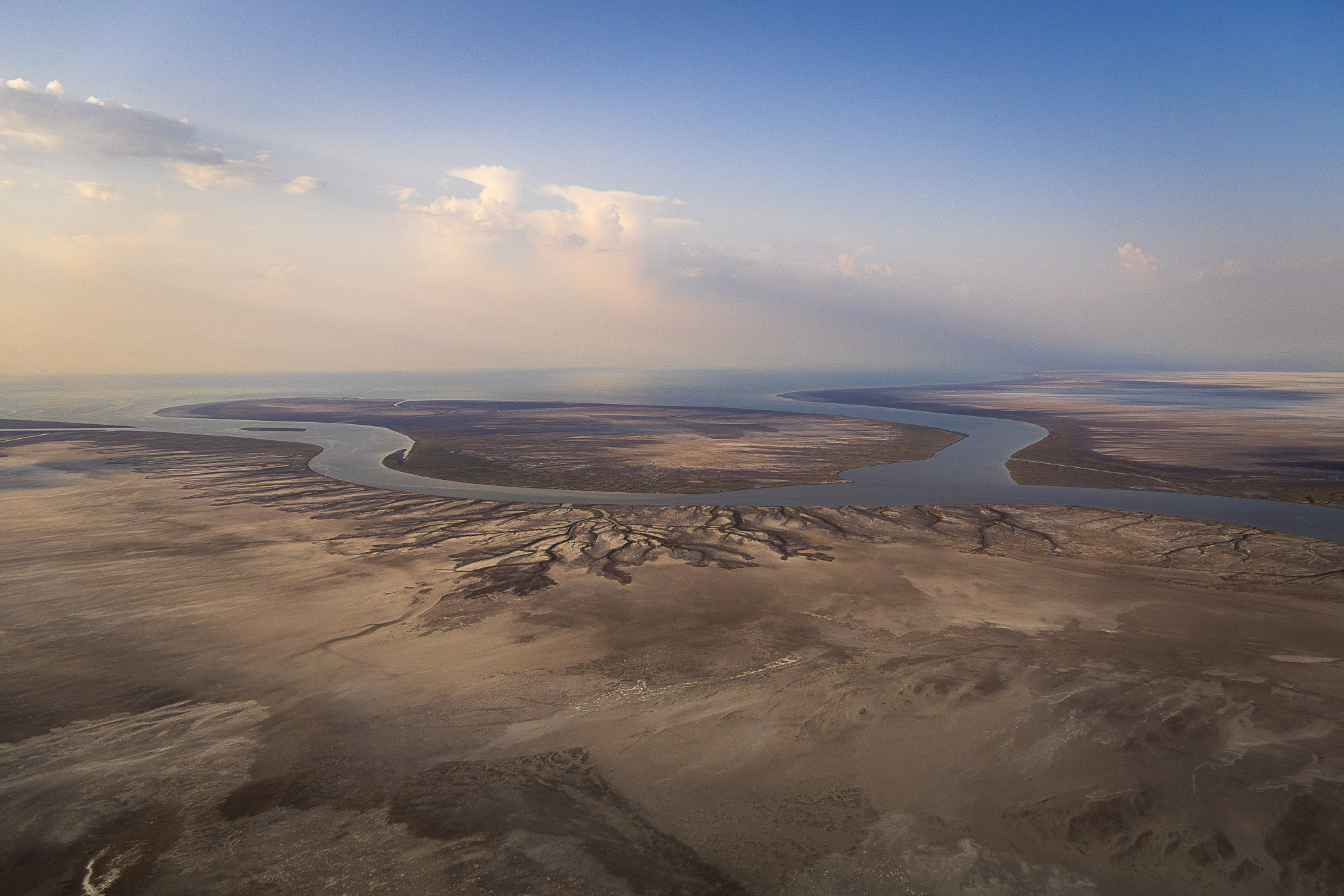
In your series “Overshoot,” the central subject—the aquifer itself—can’t be seen. How do you make depletion and disappearance visible without photographing the source directly?
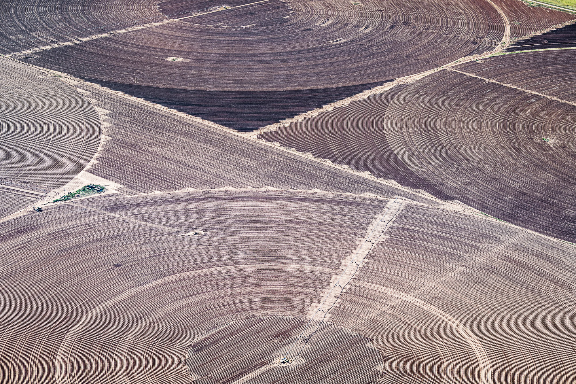
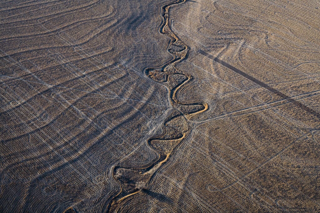
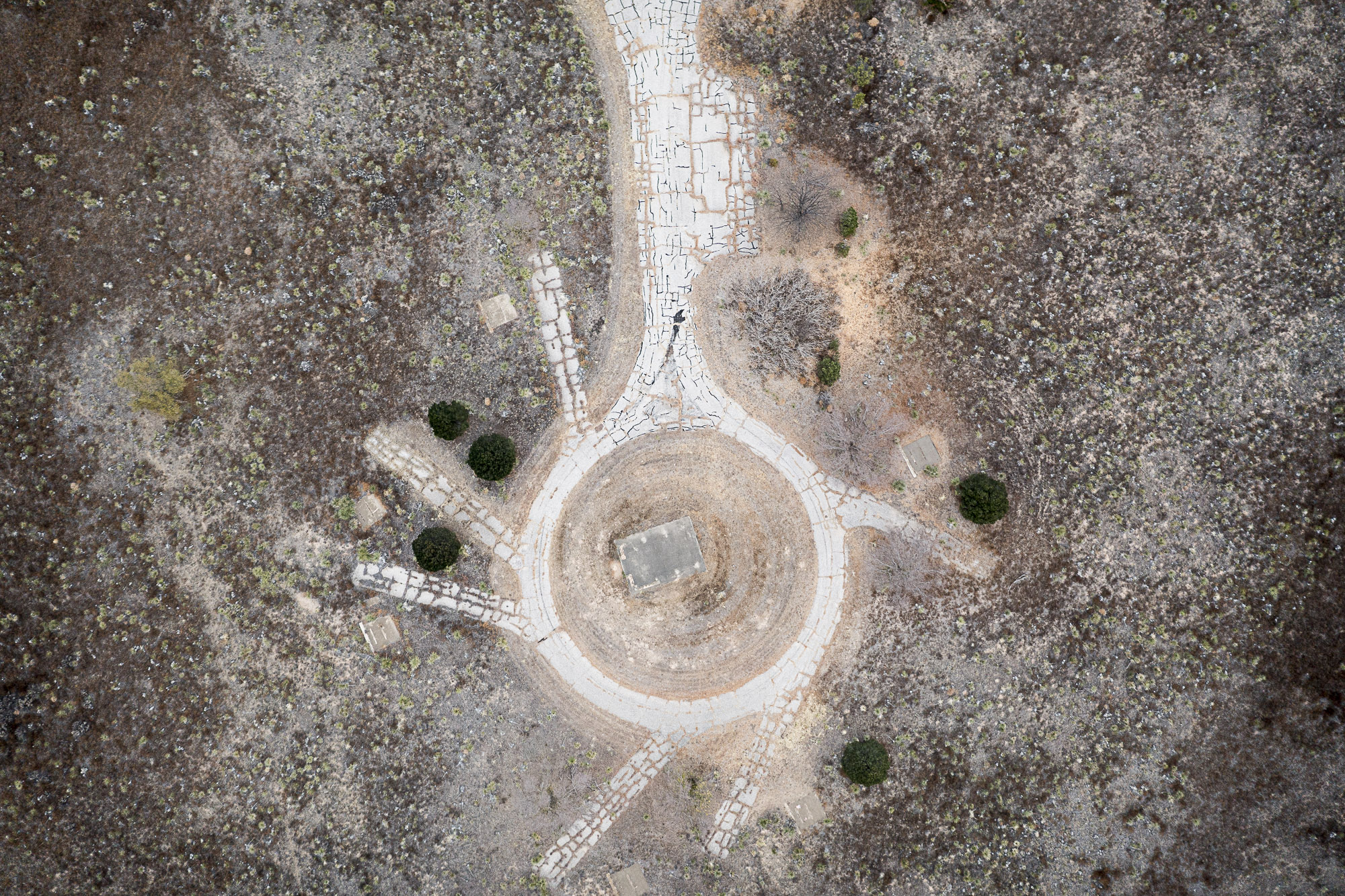
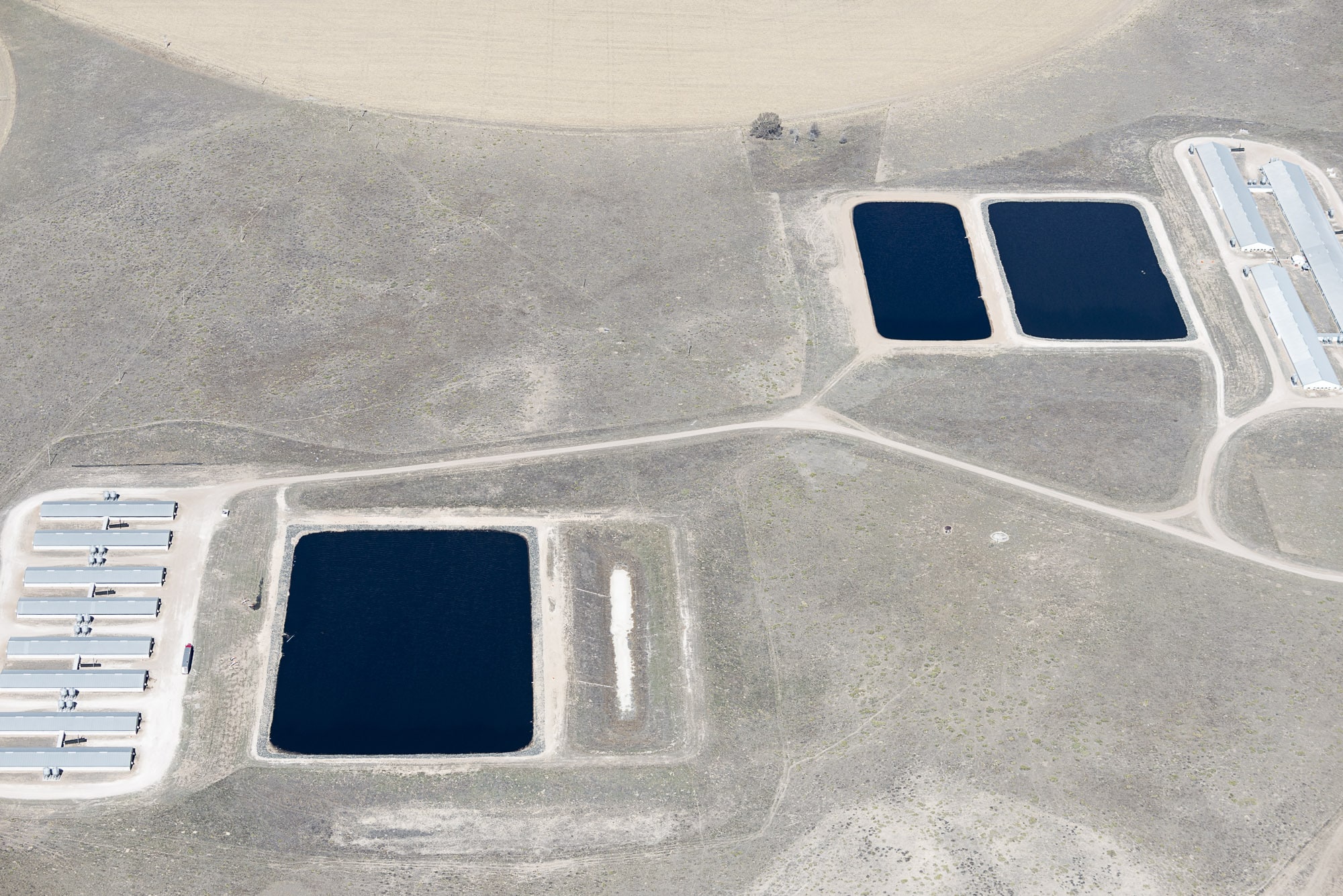
My Overshoot project directly confronts this problem: how do you photograph something underground and invisible? I’ve approached it by focusing on what the water sustains—the feed crops that power concentrated animal operations within our industrialized food system. The aquifer’s footprint stretches from Texas to South Dakota, and from the air the pivot-irrigated circles stretch from horizon to horizon. Over time, some circles visibly shrink or disappear as wells run dry, and the absence reveals itself through what can no longer be sustained.
How did you arrive at beginning this project?
I was flying back to Denver from New York in spring 2019, looking out the window as we descended. The sun was low, casting yellow light across the landscape, and out of the darkness circular forms began to emerge—dark against the dormant grasslands. In that moment I had an entry point for a project I had long been putting off. A few days later I flew out over eastern Colorado and noticed pivot-irrigated circles that appeared abandoned—likely because well yields had dropped below what was viable. That flight provided the spark to finally begin.
Can ou tell us more on the Aquifer?
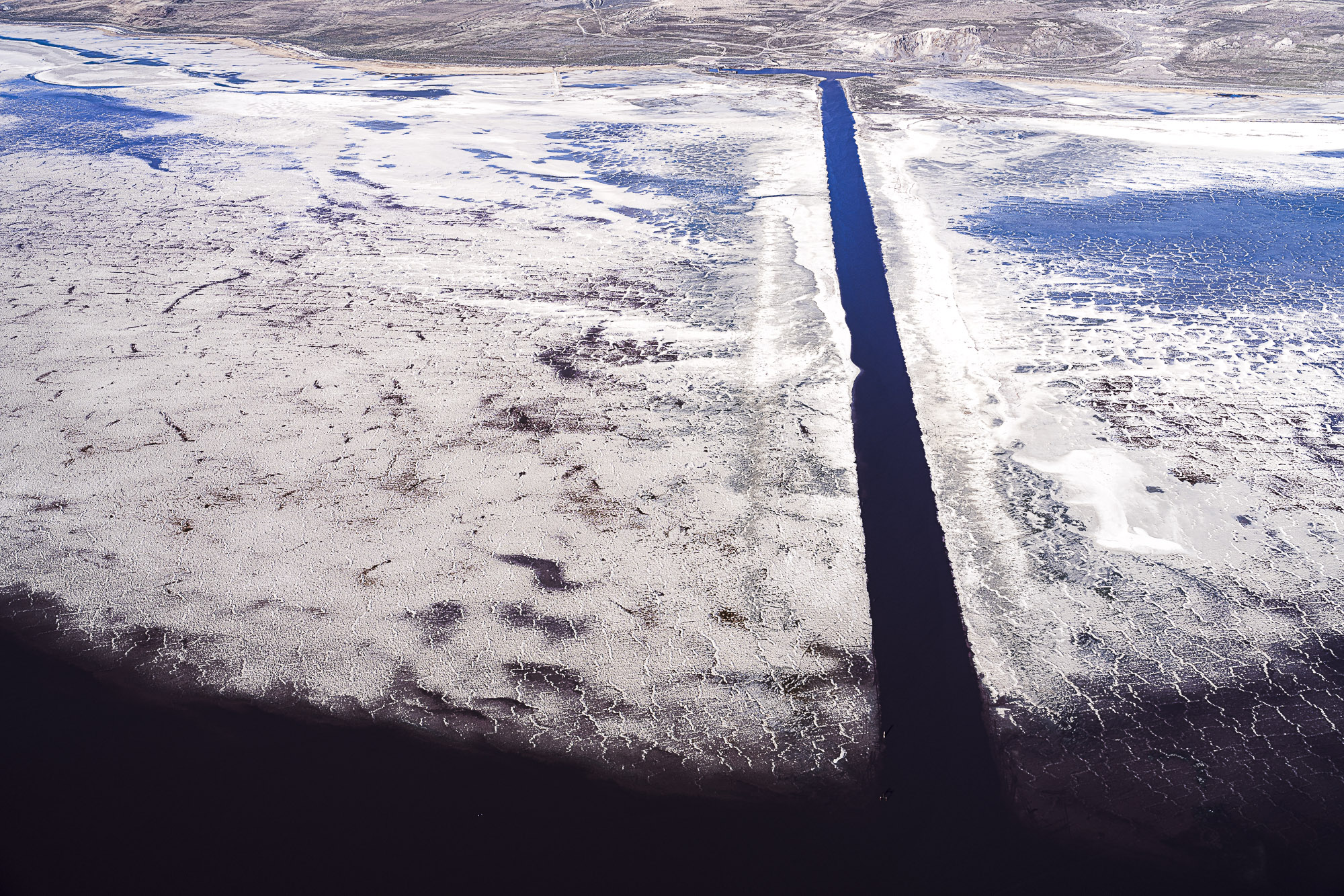
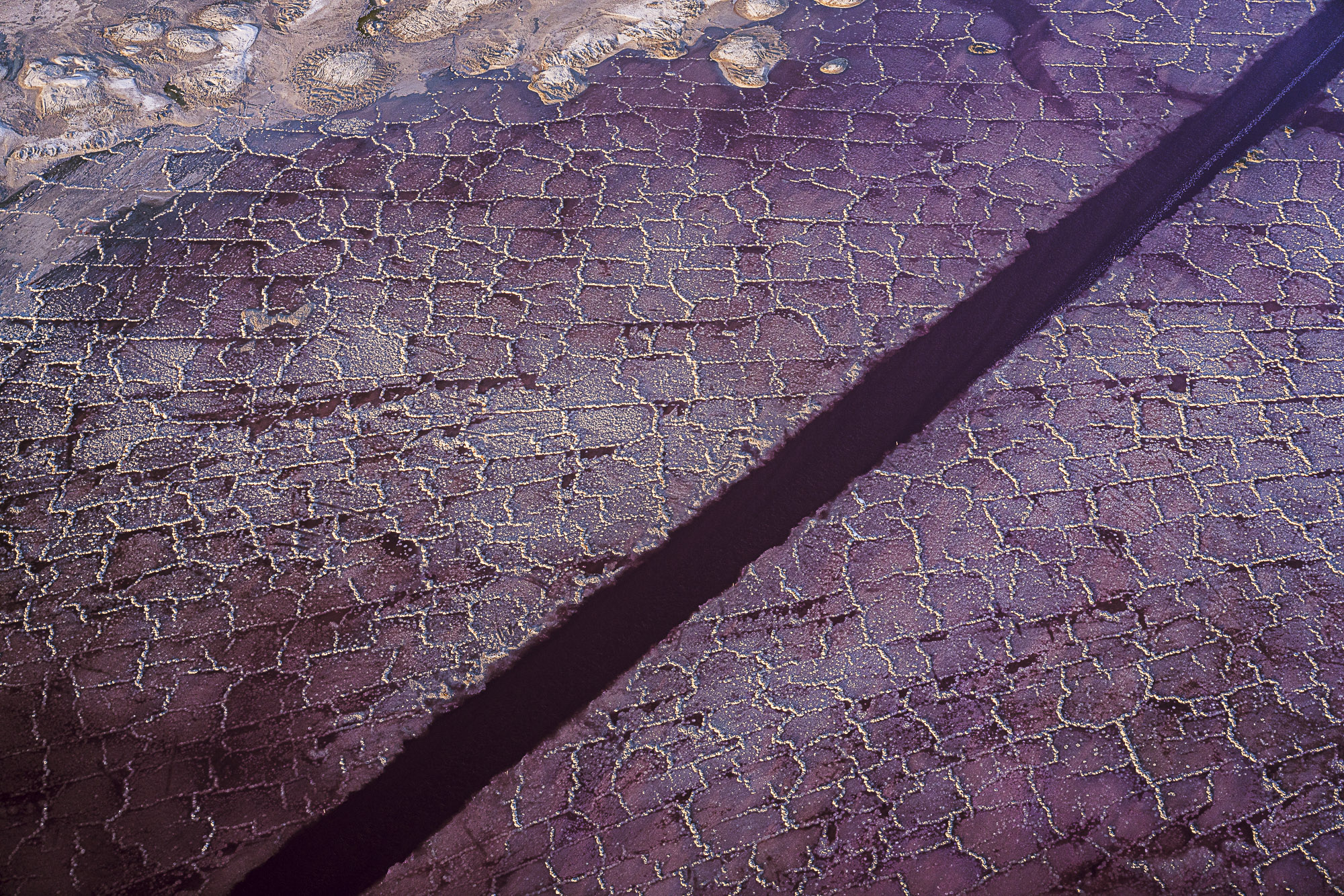
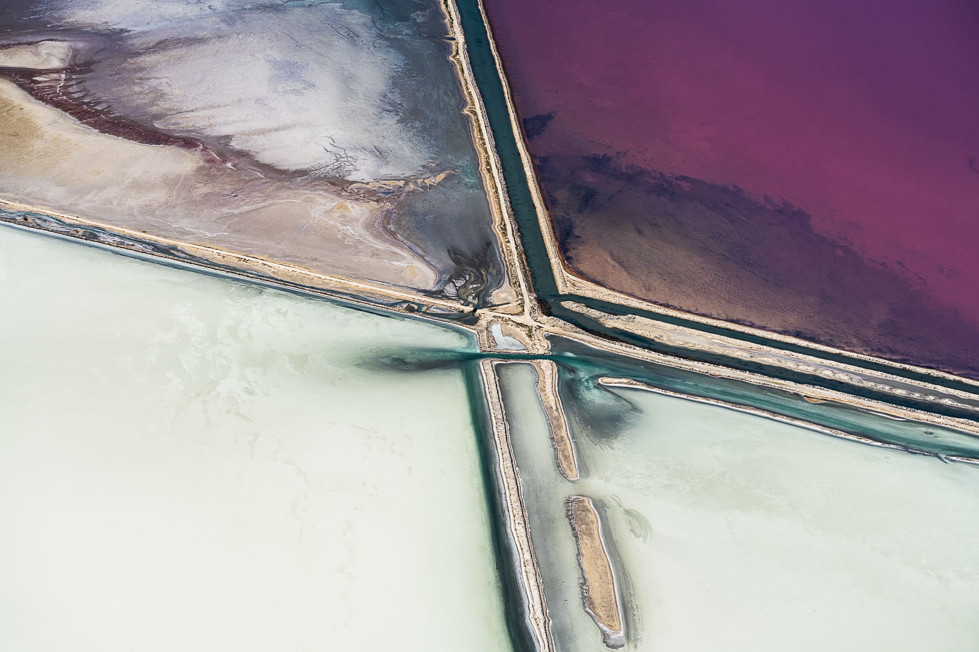
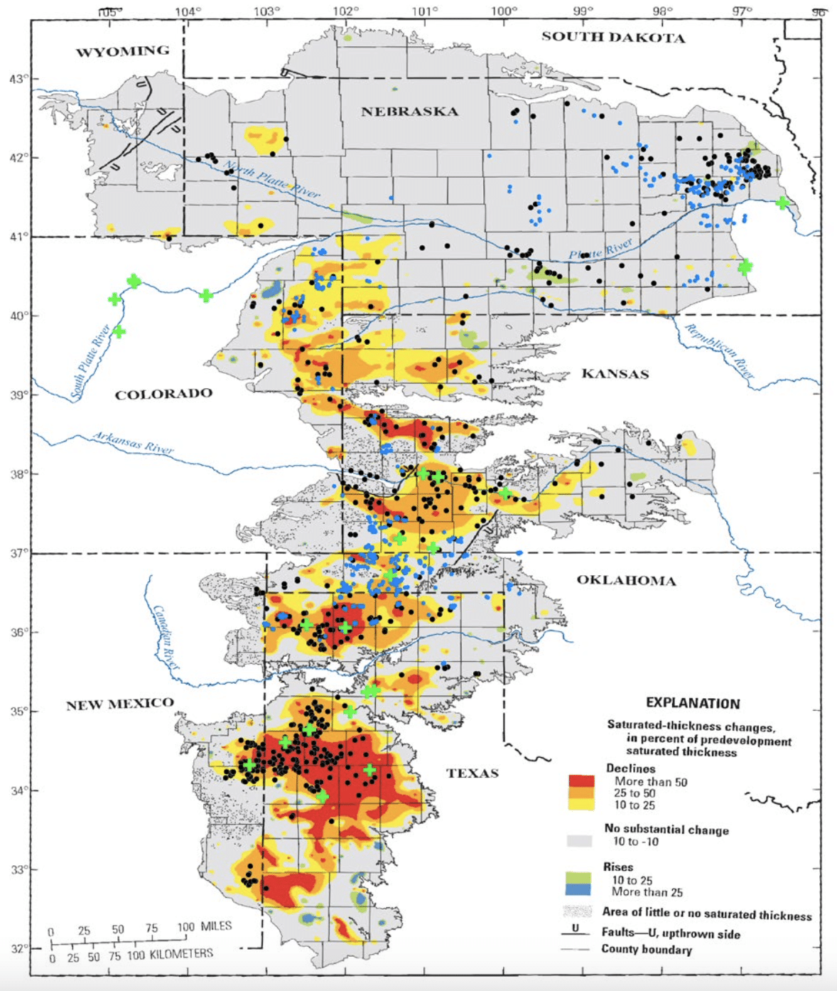
The Ogallala Aquifer, one of the largest freshwater aquifers in the world, underpins much of American industrial agriculture. Stretching beneath eight states, it supplies water for nearly one-fifth of U.S. wheat, corn, and beef production. Yet this vast resource is in sharp decline, making it a clear example of ecological overshoot.
In the mid-20th century, technological advances such as high-capacity pumps and center-pivot irrigation transformed the arid High Plains into a major agricultural engine. These tools enabled farmers to extract groundwater at unprecedented scales, driving rapid growth in crop production and, in particular, water-intensive livestock operations. Today, the southern reaches of the aquifer are marked by thousands of feedlots and concentrated animal barns—visible signs of an economy built on abundant water.
Beneath this apparent productivity, the aquifer is steadily drying up. Since the 1980s, U.S. Geological Survey data has documented significant declines in groundwater levels, especially in Texas, Oklahoma, and parts of Kansas. By layering USGS maps of saturated thickness loss with aerial and satellite imagery, this work reveals a striking alignment: the areas of most intensive animal agriculture correspond to the greatest losses of groundwater.
This project examines how consumption—particularly demand for meat—accelerates environmental depletion, asking what happens when natural limits are exceeded and who ultimately absorbs the consequences. With decentralized groundwater governance and few meaningful restrictions on extraction, the Ogallala faces what has been described as a “long farewell”: a slow, uneven collapse in which irrigation is abandoned field by field.
And can you tell us more about the term overshoot?
Overshoot is a term that was coined by William R. Catton in 1980 to describe the situation when the ecological footprint of a human population in a geographical area grows so fast that it exceeds that place’s carrying capacity, damaging the environment faster than nature can repair it. This potentially leads to an ecological and, therefore, a societal collapse. The High Plains region of the United States is largely supported by the excessive extraction of water from the Ogallala Aquifer, making this a case of overshoot. This project seeks to document from an aerial perspective the effects that the excessive extraction of water from the Ogallala has on the landscape.
From the air, environmental change can register differently. Over the years, what shifts have you witnessed accumulate across the landscapes you fly over?
The biggest change I’ve noticed is that the skies have become much hazier over the last fifteen years—whiter than the brown cloud I grew up with in Denver, but far more ubiquitous wherever I fly. I’ve also observed that pivot-irrigated circles in some areas are getting smaller, suggesting wells can no longer draw as much water as before. And burn scars from wildfires have multiplied: I often find myself flying over one I hadn’t noticed before.
You often fly over the same areas repeatedly. What changes become noticeable only by returning over time, and how do those changes show up in the landscape?
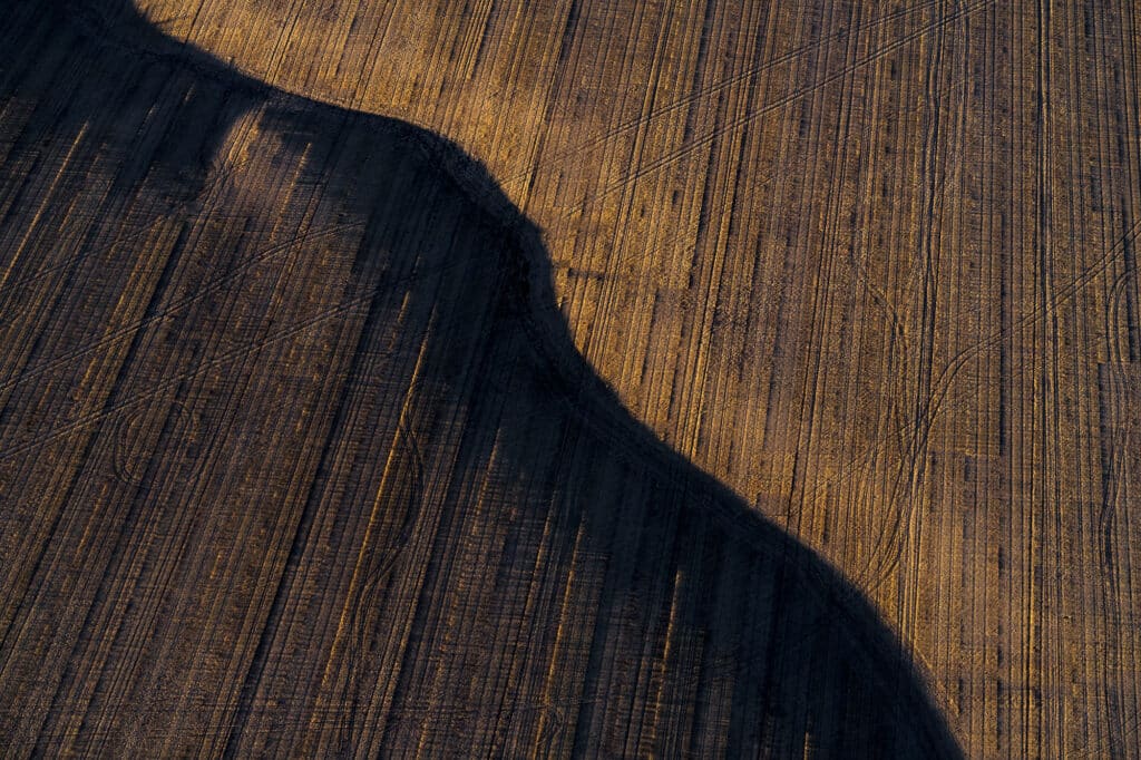
The changes I observe on the Eastern Plains are largely tied to agricultural activity. There is a certain rhythm there that unfolds at a pace mostly invisible to people living modern lives. Fields are planted, crops grow, mature, and are harvested, leaving the ground fallow before it is turned under again as the growing season begins. We intuitively know this cycle exists, but we rarely have the ability to witness it firsthand. My photographs of farmers’ fields, taken over many years, allow viewers to study the beauty of these cycles, feel their rhythms, and gain a deeper understanding of what is happening on the Eastern Plains.

From an aerial perspective, how does human activity register in the landscape—and are there places where it becomes less visible?
It’s very hard to find any place in the United States where the hand of man is not immediately apparent, though there are parts of the western states where those signs are farther apart. The first giveaway is the grid system devised by Thomas Jefferson in the 1780s, which divides much of the land into supposedly affordable and sustainable parcels.
In more sparsely populated areas, where the grid is less apparent, you can begin to imagine that the landscape looks much the same as it did a thousand, ten thousand, or even a million years ago. Even then, there are telltale signs of civilization—a road, a fence line, really any straight line is a dead giveaway—and from there, the evidence only increases.
How do you think the aerial perspective helps—or hinders—the viewer in understanding the scale or urgency of what’s happening?
In this era of satellites and Google Maps, most people are familiar with the aerial perspective, but that doesn’t mean they always understand what they’re seeing. I’ve had an interest in looking out of airplane windows from a young age, and over time that experience refined my ability to read the landscape in three dimensions. Combined with my background in geology, I think I have a more developed understanding of what I’m looking at. For many others, aerial images can seem confusing or abstract. When the subject isn’t immediately legible, the scale of what’s happening—and the urgency of it—may not fully register.
You’re documenting landscapes shaped by extraction—do you see the land adapting in any way, or simply enduring? And what story does that tell?
As a geologist, I know the planet has survived far greater disruptions than what we are inflicting now—from a geological perspective, it will likely survive just fine. But the intensity and speed of extraction over the last fifty to a hundred years is unprecedented, and that puts us in a fundamentally different situation. Whether the Earth regenerates with or without us may not be the real question. The more pressing one is what this level of impact means for the conditions that allow human life to persist.
When someone first encounters your photographs, what do you want them to register before anything else—and what do you hope lingers after they’ve looked longer?
I want to draw them in with the beauty first, and then engage their curiosity about what they’re actually seeing. Ideally, the image sticks with them long enough to prompt questions about the environment around them, to become more engaged with the issues at play, and perhaps to think about how we might change things so we’re living in greater harmony with our environment.
More information about Evan Ederman on his website.