Nearly four decades after our first trip to the Himalaya in 1981, we started looking once again at the photographs and journals from our travels. Thousands of Kodachrome color slides in plastic sheets lay dormant in archival boxes.
We carried these with us from our home in California to our first overseas job posting in Jakarta, Indonesia, and then on to subsequent postings in Warsaw, Poland, Indonesia again, and Almaty, Kazakhstan, until our last posting in Kabul, Afghanistan, when the slides joined other personal effects in a storage unit outside Washington, D.C. From time to time we pulled out the boxes and looked briefly at a few images, and several times Bill made prints for photo exhibitions in Jakarta, Warsaw, and Almaty. For the most part, though, this storehouse of visual memories remained untouched for decades.
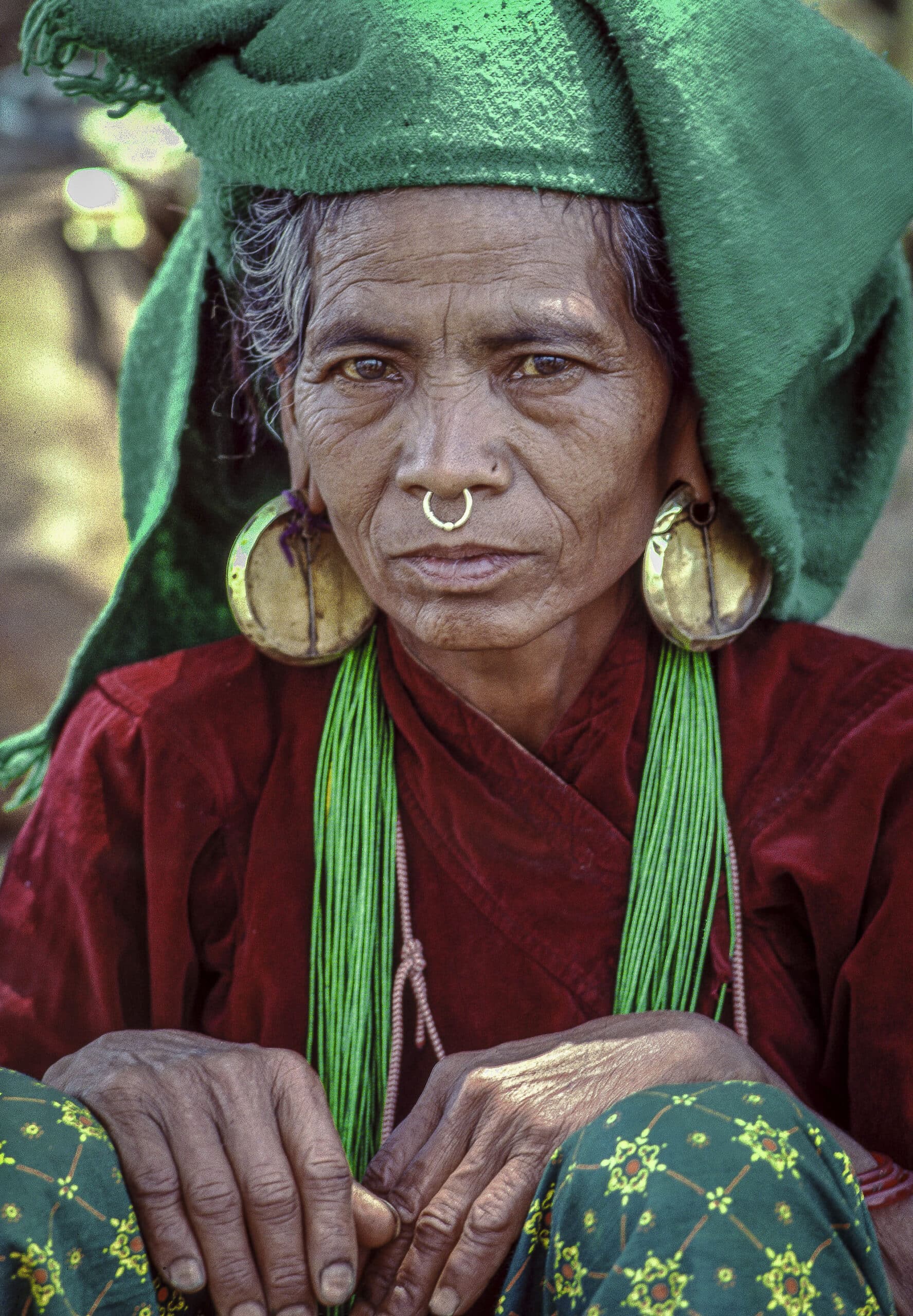
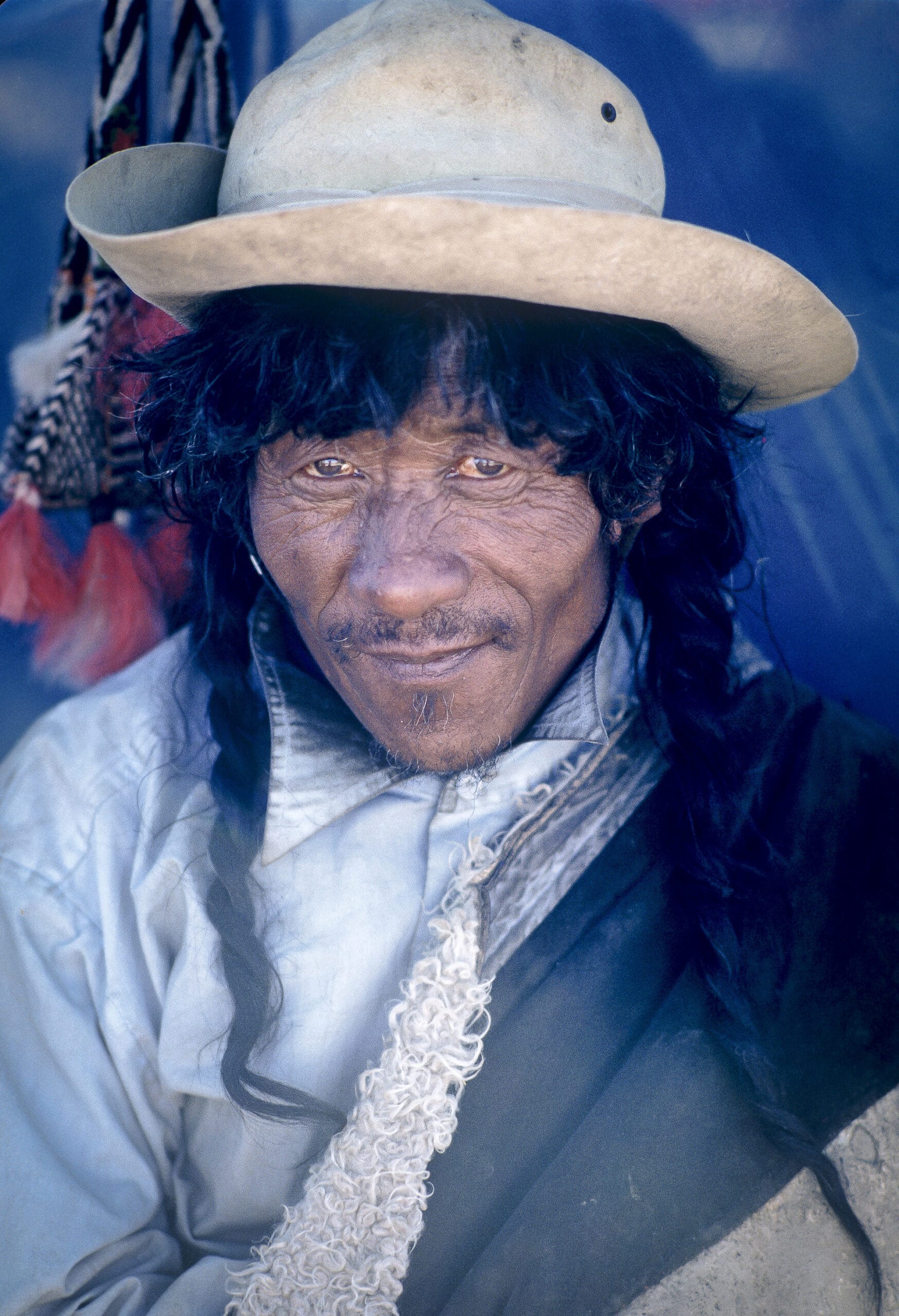
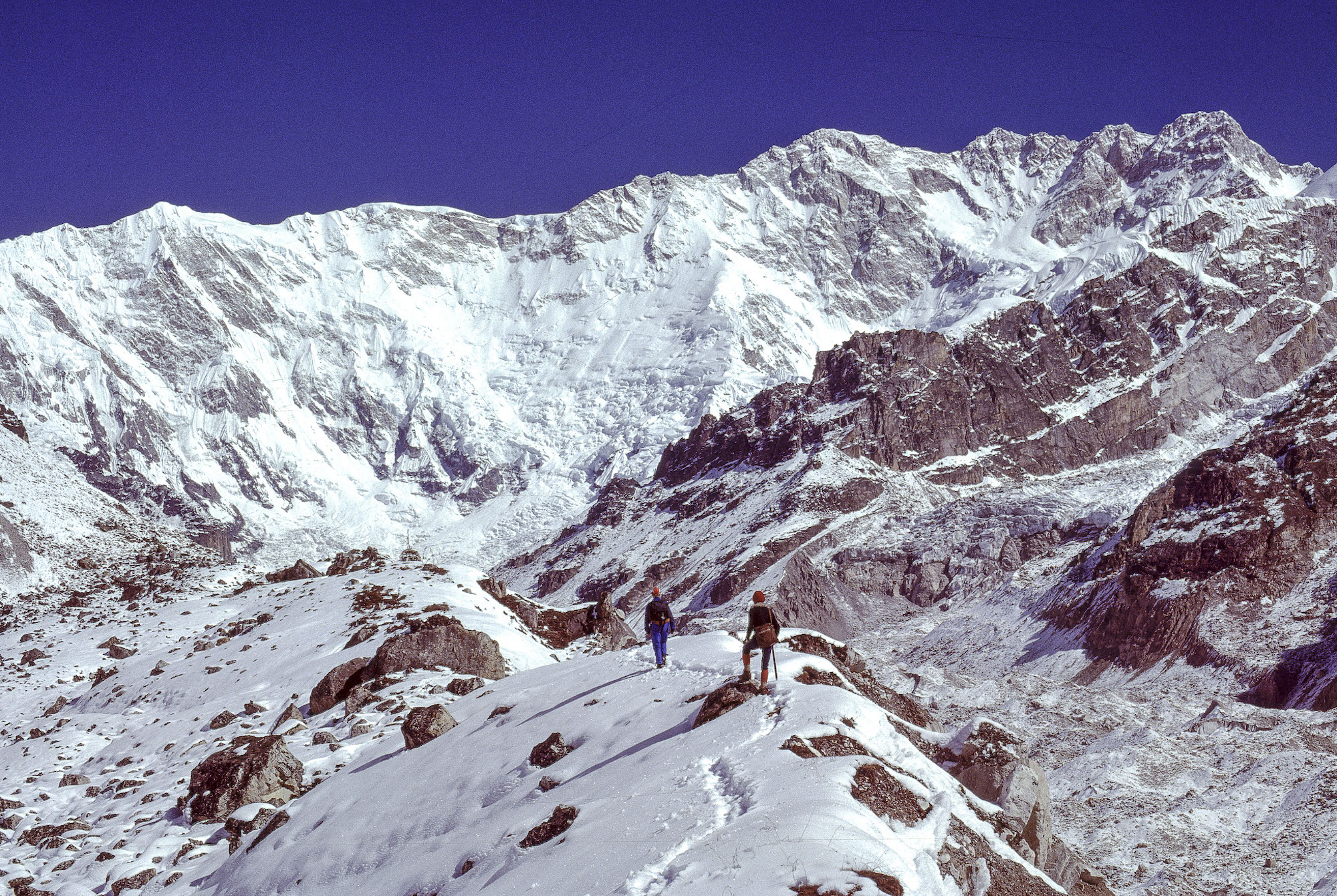
Memories flooded back once we started looking at the images again. There were spectacular mountain scenes, as well as the familiar faces of the Nepali porters we hired to carry our bags and provisions on treks, women from faraway villages adorned in heavy gold jewelry, and playful little boys studying at monasteries who must be middle-aged monks now.
We marveled that it was possible for us to remember all these people so vividly and wondered if they remembered us, too. We realized that what had started off in 1985 as a hiking vacation to Mount Everest and Khumbu, Nepal, had become a pilgrimage of sorts. It led us to a lifelong interest in the people and cultures of the mountain communities stretching from Central Asia across Tibet, India, Pakistan, Nepal, and Bhutan.
We did two long treks in Nepal during the early 1980s before taking an extended twenty-month trekking sabbatical to the base camps of the world’s ten highest peaks in 1985 and 1986. After that, we traveled to Nepal and northern India and other mountain regions as often as our professional lives would allow.
Our preferred mode of travel was trekking — hiking on mountain trails for extended periods and spending nights along the way, either in a tent or a simple lodge. Unlike mountain climbing, trekking does not require technical skills or equipment — a good pair of boots, a waterproof rain jacket, a warm sleeping bag and inflatable mat, and a backpack are the essentials. Treks usually involve a destination, but the most important element is an unhurried pace with time to experience mountain scenery and local cultures.
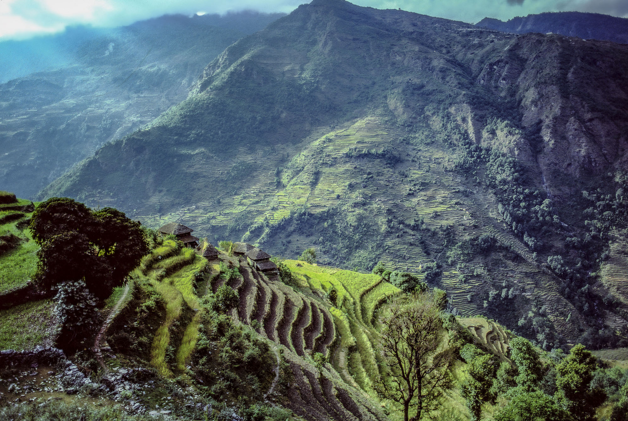
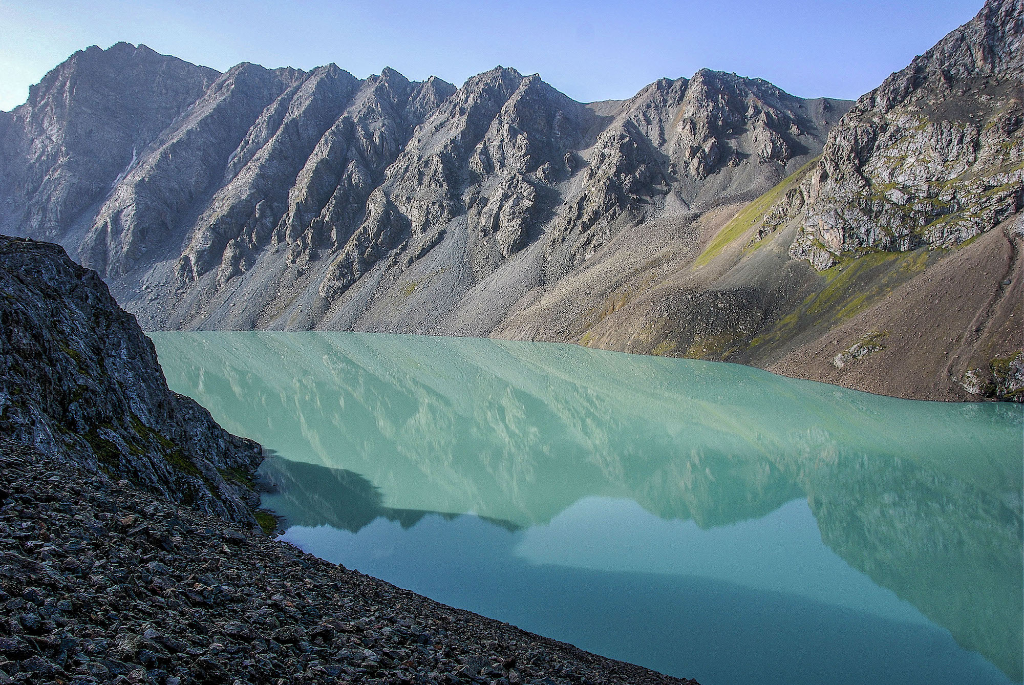
Around Manaslu, Nepal
Our fascination with high mountain peaks and a love of walking drew us to Nepal for the first time in November 1981. From the moment we stepped off the plane in Kathmandu, we knew that this was a magical place, unlike any we had ever experienced. As we rode from the airport to our hotel in Thamel, the backpacker neighborhood, the view through the taxi’s windshield became clearer.
Bumping along a potholed road, we passed medieval-looking, three-story brick buildings with carved wooden latticework windows. Children played under the branches of an ancient banyan tree spreading over a courtyard. Men on bicycles and stray cows wove in and out of the traffic in front of us, competing for space with other taxis and dilapidated buses.
We looked to the right, and along the Bagmati River we spotted smoke rising above a row of Hindu temples with arched facades and stepped pagoda-like roofs. We learned later that this was Pashupatinath Temple, a sacred place where Hindus cremate their dead. Always in the background, towering over these scenes, were the snow-capped Himalayan peaks we had seen in the distance as we flew into Kathmandu. It was our first day in Asia and the start of a lifetime of journeys in the mountain regions of the Himalaya Range and its borderlands.
On our first trek in Nepal, we walked around Manaslu, the world’s eighth-highest mountain (26,781 feet), located in west-central Nepal. Known by some as the Japanese Mountain, it was first explored by Japanese climbers during the early 1950s and then successfully climbed by a Japanese expedition in 1956, in spite of an encounter a year earlier with angry villagers who believed the climbers had angered the mountain gods, resulting in an avalanche.
Partly for this reason, Manaslu was not climbed again until 1971 by another Japanese expedition. Although the peak is considered to be relatively easy to summit under ideal conditions, it has a history of deadly avalanches.
At our first group meeting at the hotel in Kathmandu, it was clear that everyone was nervous about the prospect of walking at high elevations on narrow and sometimes steep and exposed trails. Most of us in the fifteen-member Sierra Club group, with the exception of our leader, had never been on a Himalayan trek before.
Reality hit me the next day as soon as we all stepped off the bus from Kathmandu to the town of Kurin Ghat and came face to face with a rickety pedestrian suspension bridge with missing wooden slats high above the Trisuli River. Swallowing my fear of heights, I started across, slowly, swaying with every step and bouncing up and down as more people entered the bridge behind me.
We soon got into the trekking pattern of waking early every morning when members of our Nepali crew thrust cups of hot lemon tea into our tents and placed a shallow pan of warm washing water outside. Before hitting the trail, we ate a breakfast of hot porridge or cornflakes and drank cups of coffee made with powdered Nescafé.
We hiked all morning before lunch, which usually consisted of eggs, French fries, and warm chapatis, Indian-style flatbread cooked over the fire. After lunch we hiked until late afternoon, logging twelve to fifteen miles per day before stopping at a campsite deemed suitable by Jagatman, our sirdir (head guide). After the Nepali porters helped us put up our tents, we spent the time before dinner writing in our journals, drinking tea, tending to blisters, and rearranging the contents of our duffel bags.
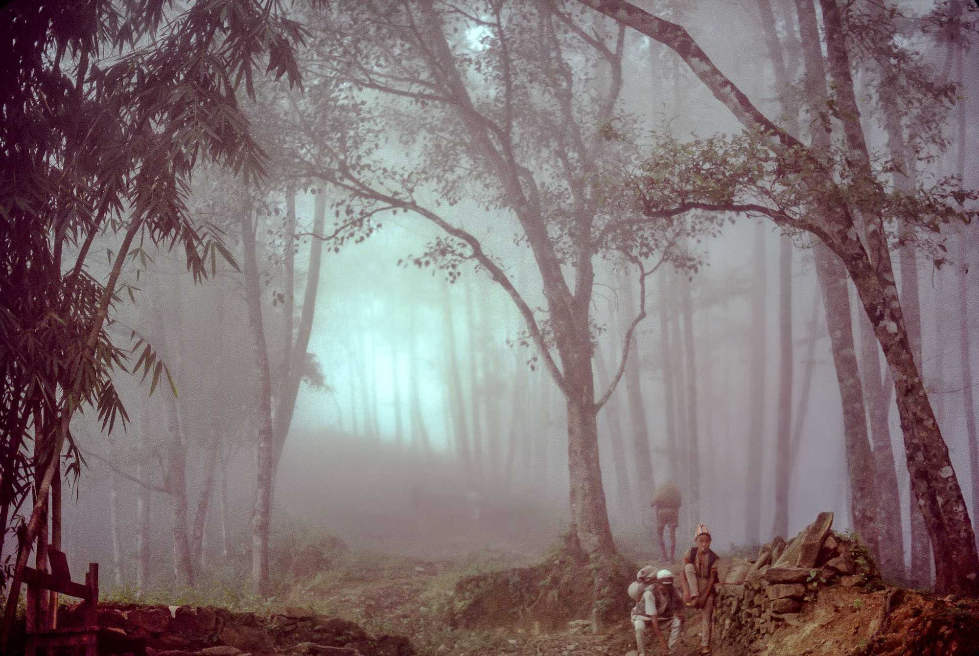
Hiking Up and Down
Most evenings, local people from a nearby village would crowd into our dining tent, standing at the edges and marveling at us, as well as the canned fruit cocktail we enjoyed after our supper of dal bhat (rice and lentils) and vegetables.
For entertainment after dinner we took turns reading aloud from The Ascent of Rum Doodle, a 1956 parody of early “siege-style” mountain climbing expeditions that used large numbers of high-altitude porters, tons of equipment, supplemental oxygen, successive well-stocked camps, and fixed ropes along the route to the summit. To reach the top of Rum Doodle, a mythical 40,000-foot peak located in the county of Yogistan, the fictitious climbing team employed 3,000 Yogistani porters, each carrying a load of 1,000 pounds. Our trekking group, complete with dozens of porters and a huge cook staff, seemed almost as unwieldy to me.
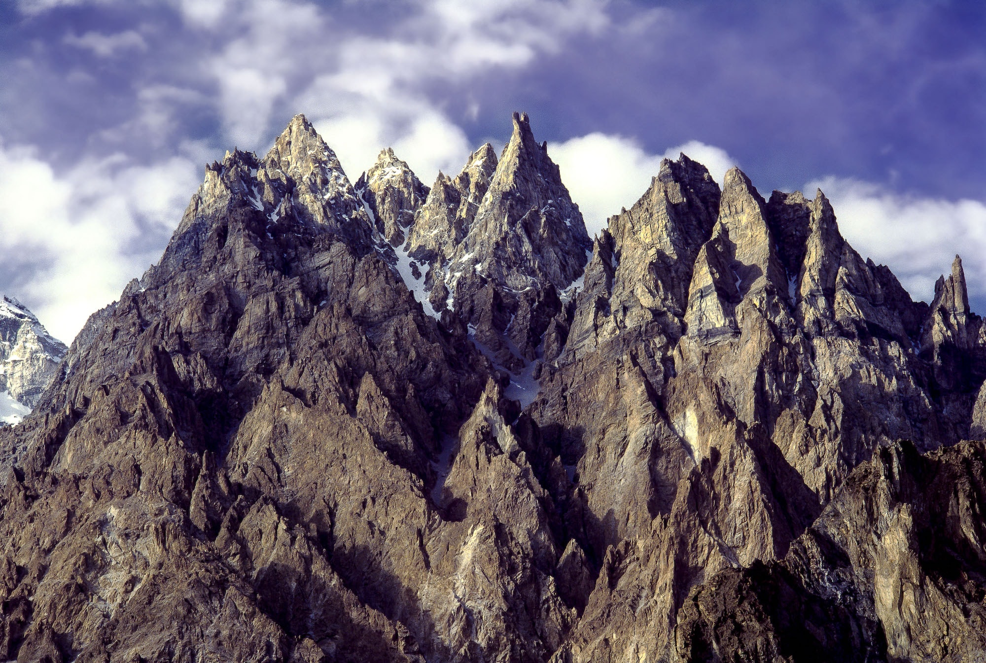
The first few days of our trek were hot and steamy as we hiked up and down hills in lush, low-altitude forests on our way to higher elevations. On the morning of the fourth day, we saw snow peaks for the first time: Annapurna South, Himalchuli, and the Ganesh Himal Range. The trail became steeper and more exposed, with precipitous drop-offs down to the rushing, gray-colored river below. The nights got colder, and water bottles partially froze inside the tent.
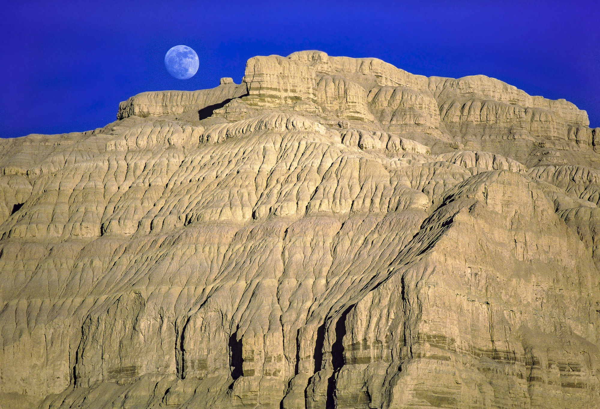
On forays out of the tent in the middle of night, I often saw snow-covered mountain peaks glowing luminously in the moonlight. On the ninth day, as we continued walking on the cliffs above the Buri Gandaki River, we began to encounter traders from near the border of Tibet walking alongside mules loaded with yak-skin bags filled with salt and butter and animal skins. We crossed into a restricted area at the village of Jagot and learned from authorities there that no foreign trekkers, only mountaineering teams, had ever been this far before.
At the next police checkpoint, three days later, the authorities were not so welcoming; we were now quite close to the border with Tibet, a sensitive area because of the Chinese occupation, since 1950, of what many consider an independent state. Somehow, we were able to convince them to let us continue, arguing that we had come so far already and it would be a shame to turn around.
We were less than ten miles from the Nepal–Tibet border, passing through villages where inhabitants of Tibetan descent known as the Nubri had limited contact with people outside their immediate environs. This area remained officially off-limits to foreign trekkers until the early 1990s, but today is open to trekkers with a restricted area permit, with teahouses available for trekkers.
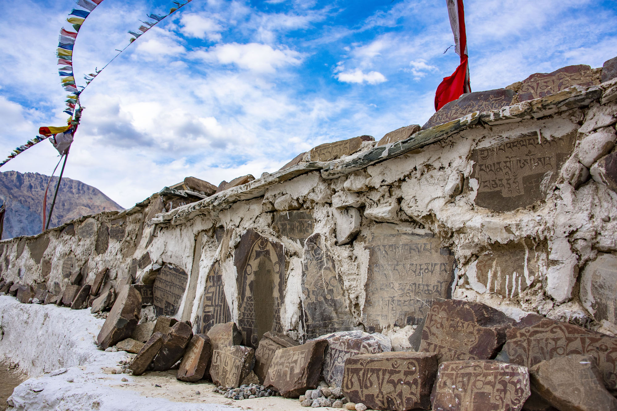
We began seeing long mani walls made of hundreds of flat stones carved with inscriptions and prayers, especially the Buddhist mantra Om Mani Padme Um (Oh, jewel in the heart of the lotus), as well as stupas. Stupas, known as chortens in Tibetan, are religious monuments found all over the Buddhist world that commemorate people and events. They appear in all sizes from small, simple constructions of stone and plaster to large, two-level structures that one can walk through.
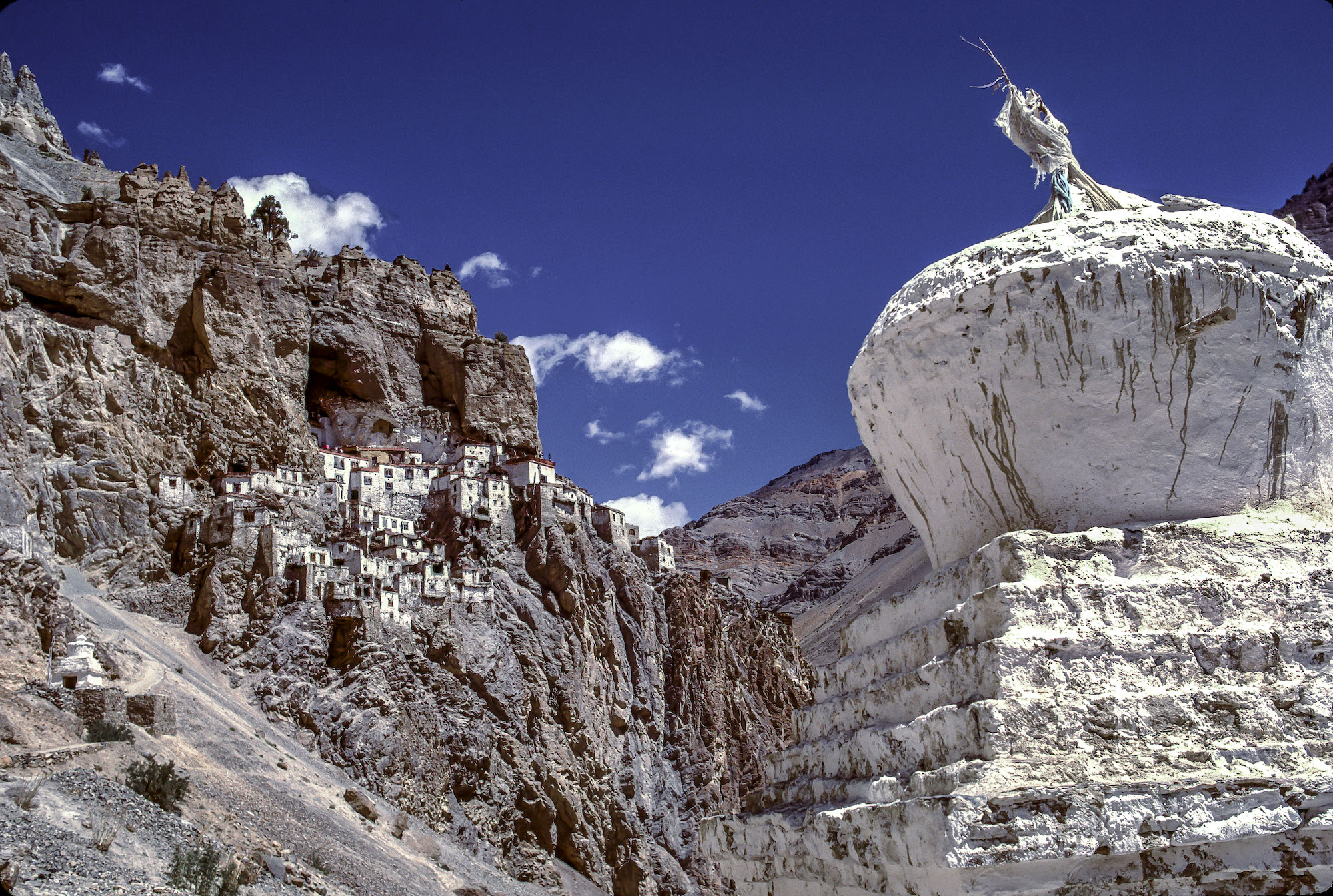
In the village of Sama, not far from the base camp of Manaslu, we were invited into a Tibetan Buddhist temple, known as a gompa or gomba to witness a ceremony that must have been hundreds of years old. We did not know the meaning or purpose of this religious ritual but were transfixed by the sight of some twenty red-robed monks and students of all ages seated at low tables in a square configuration and chanting in unison.
At the height of the ceremony a ray of sunlight struck the gold-leaf-covered statue of the Buddha on the altar at the front of the room. Soon after, strange cone-shaped offerings made of butter and tsampa (barley flour) were placed outside by a monk and quickly snatched up by huge black crows. This vivid introduction to Tibetan Buddhism ignited our interest and made Bill and me want to learn more about this religion and the ancient cultures associated with it.
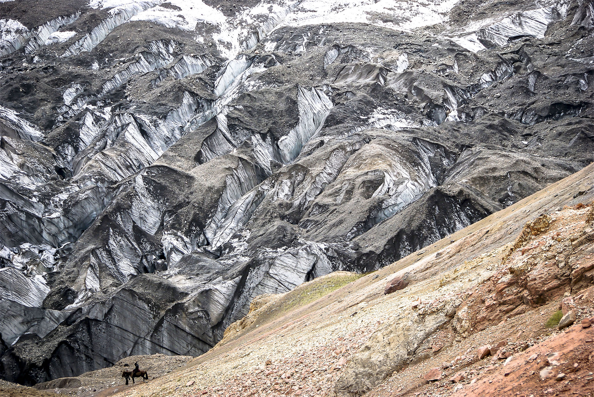
The high point of our trek around Manaslu was Larkya La, a mountain pass (elevation 16,752 feet) that was covered in several feet of snow on the day we crossed it. (La means mountain pass.) The night before our approach to the pass we slept at 15,000 feet. Starting in the dark at 5:30 AM the next day, we walked slowly up to 16,000 feet and stopped for lunch.
Everyone in our group, including the porters, had a bad headache and nausea from the altitude. Several porters were seriously sick, so some of us trekkers took extra weight from their loads and put it into our backpacks. Two hours later, we reached the top of the pass where we could see Annapurna II, the Nilgiri peaks, and many other mountains with elevations greater than 22,000 feet. Getting down the other side of the pass required stepping into deep snow on steep terrain.
With lots of confusion on the way down from the pass, our small group of four people lost the route and ended up on a ridge with no trail in sight as the sun set and it got darker and darker. We turned on our headlamps and waited; finally, in the distance we saw lanterns and the flashlights of the porters walking back to find us and lead us down the ridge to our camp.
For a week, we worked our way back to the town of Pokhara along the Dudh Khola River on the western side of Manaslu. We were generally heading downward in elevation, but there were still plenty of up-and-down hikes each day. At one high point, we looked back and saw a line of peaks: Manaslu, Peak 29, and Himalchuli in the foreground with Annapurna II, III, and IV, and Machapuchare in the distance.
Our food supplies began to dwindle during the last week, so our cook bought a butchered water buffalo in a small village. I spent half a day walking behind a porter who carried a basket on his back filled with furry legs and fly-covered meat which reappeared as buffalo curry that evening. Our companionable group hiked in groups of two or three, and all we talked about on the trail was the Thai food we would find in Bangkok on the way home.
Finally, on the twenty-ninth day after embarking on the trail in Kurin Ghat, our trek ended suddenly, and we boarded a bus back to Kathmandu. A mix of emotions, from relief to exhilaration, hit me. In Kathmandu we slept late, took showers, drank ice-cold Kingfisher beers at the Rum Doodle Bar, and ate chocolate cake at KC’s Restaurant.
In spite of our delight in creature comforts, we were already planning our next trek into the mountains. Bill and I realized that we could live for a while, perhaps months, without modern conveniences if it meant access to faraway, untouched mountain areas. We loved the rhythm of simply walking for hours and focusing only on the trail stretching out in front of us for miles.
The most exhilarating aspect was the mountain scenery we viewed along the way. The world’s highest peaks inspired us and created a reverence for their environments and the cultures surrounding them.
Travels Across the Roof of the World: A Himalayan Memoir, by William and Anne Frej, published by George F. Thompson Publishing, 280 pages, $55.